


RunwayMap
Aviation Weather
RunwayMap: Aviation Weather介绍
RunwayMap是排名第一的飞行员社区。您可以查看其他飞行员的飞行视频,评论和照片,以及分享您的飞行体验。
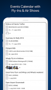
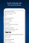
需要一些想法,为您的第二天旅行? RunwayMap活动日历显示机场节日,飞入和老式飞机表演等活动。
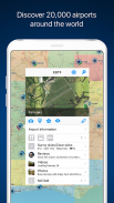
交互式地图为您提供机场概览。我们收集了每个机场的重要信息:
•航空天气预报
•跑道和NOTAM
•3D和卫星视图
•网络摄像头等等
RunwayMap简化了飞行准备并补充了SkyDemon,Jeppesen和Garmin Pilot等飞行计划工具。
在您使用时下载多功能飞行员应用程序。
特征:
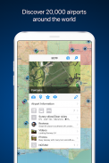
地图
按名称或国际民航组织搜索以发现新机场。接收重要信息,如当前天气,地址,位置,跑道,NOTAM和日出/日落。标记并保存您已飞往的机场或您想要飞往下一站的机场。保存每个机场的个人笔记。
活动日历
RunwayMap活动日历显示机场节日,飞入和老式飞机表演等活动。每个事件都显示从您的家庭基地到海里的事件地点的距离,以及来自RunwayMap社区的哪些飞行员也有兴趣去。
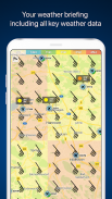
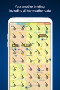
航空天气
当前的天气预报,视觉飞行条件和风力预报都显示在我们的地图上。
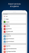
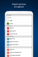
现场服务
发现机场附近的餐厅和酒店。了解公共交通和汽车租赁优惠。
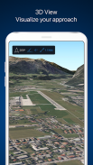
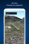
3D和卫星视图
在3D和卫星视图中查看机场环境。使用OpenStreetMap视图获取详细的车辆访问信息。
DOCUMENTS
只需点击几下,即可添加您的航班文档,例如Jeppesen进近图表,FAA终端程序和机场图,SkyDemon手册或Garmin飞行员指南。这样你总是把它们放在手边。
TOOLS
使用方便的计算器进行距离,重量,温度等的转换。让它显示您的QNH和QFE。
RUNWAYMAP APP
重要说明:RunwayMap无意提供航空信息或导航设备。出于导航目的,我们强烈建议仅使用经过批准和更新的航空信息,例如SkyDemon,Jeppesen或Garmin Pilot。
RunwayMap中显示的天气数据仅是有关可能的天气发展的一般信息。它不会取代官方机构在飞行前的专业天气简报。
在runwaymap.com上了解有关RunwayMap的更多信息
RunwayMap: Aviation Weather - 版本3.7.1
(01-04-2025)RunwayMap: Aviation Weather - APK信息
APK版本: 3.7.1程序包: ch.reddev.android.runwaymapRunwayMap: Aviation Weather的最新版本
其他版本


同类应用


